Two Streets Hold 70% of Brookline's Blocked-Bike-Lane Reports
- Jonathan Lansey
- November 1, 2026
- 3 mins
- Infrastructure
- bike bureau bike infrastructure cities parking policy road safety
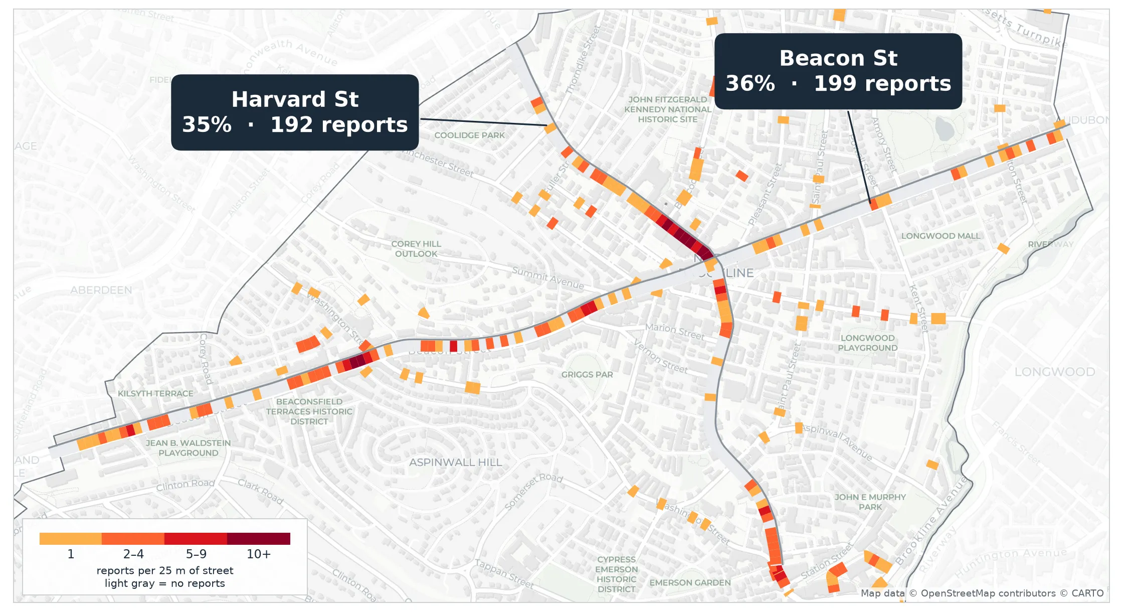
555 Bike Bureau reports, Jul 1 – Nov 1, 2026. Each 25 m stretch of street is colored by how many reports fall on it. Harvard St and Beacon St (gray side rule) are drawn end to end; other streets only where reports fall. Map data © OpenStreetMap contributors © CARTO.
TL;DR
- Riders filed 555 reports of vehicles blocking Brookline bike lanes through Loud Bicycle’s Bike Bureau between July 1 and November 1, 2026.
- Two streets hold 70%: Beacon St (199 reports, 24 riders) and Harvard St (192 reports, 34 riders).
- The densest block is Harvard St at Coolidge Corner, where flex posts installed in August cut one rider’s reports there by two-thirds.
- Harvard St was just repaved without protected lanes. This map shows where they would matter most.
What the town is doing
- Harvard St was repaved April–August 2026. The board declined protected lanes but added flex posts at some intersections, including Coolidge Corner.
- Chestnut Hill Ave gets a two-way protected bikeway in spring 2027. It has only 3 reports today, a clean baseline for a later before/after.
- Parking complaints left the town’s online form on October 1. Bike Bureau filings had roughly tripled them, so these reports are now one of the few systematic records of where Brookline’s lanes get blocked.
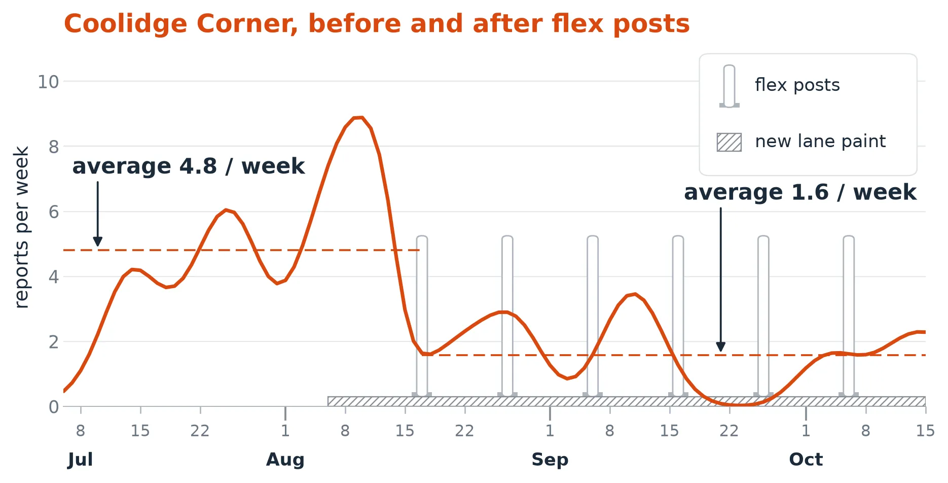
After flex posts went in at Coolidge Corner, one regular rider’s reports there fell from 4.8 to 1.6 a week. Full analysis and caveats →
The same concentration shows up in Boston and Cambridge. Brookline is the most concentrated of the three.
Caveats
- Reports track where riders ride and choose to report. For deciding where to build first, that bias mostly points the right way.
- A few riders file a lot. The 555 reports come from 58 riders, which is why we count riders as well as reports. Both main corridors draw from dozens of people.
References
- Loud Bicycle. “Bike Bureau: Report Bike Lane Obstructions.”
- Loud Bicycle. “Bike Bureau: Download Data.”
- Brookline.News. “Harvard Street is getting repaved this spring. Some advocates say the plan doesn’t do enough for safety.”
- Town of Brookline. “Harvard Street Paving.”
- Streetsblog Massachusetts. “Brookline transport board endorses Chestnut Hill Ave redesign with protected bikeway.” September 21, 2026.
- OpenStreetMap contributors; CARTO. OpenStreetMap. Basemap and street data.