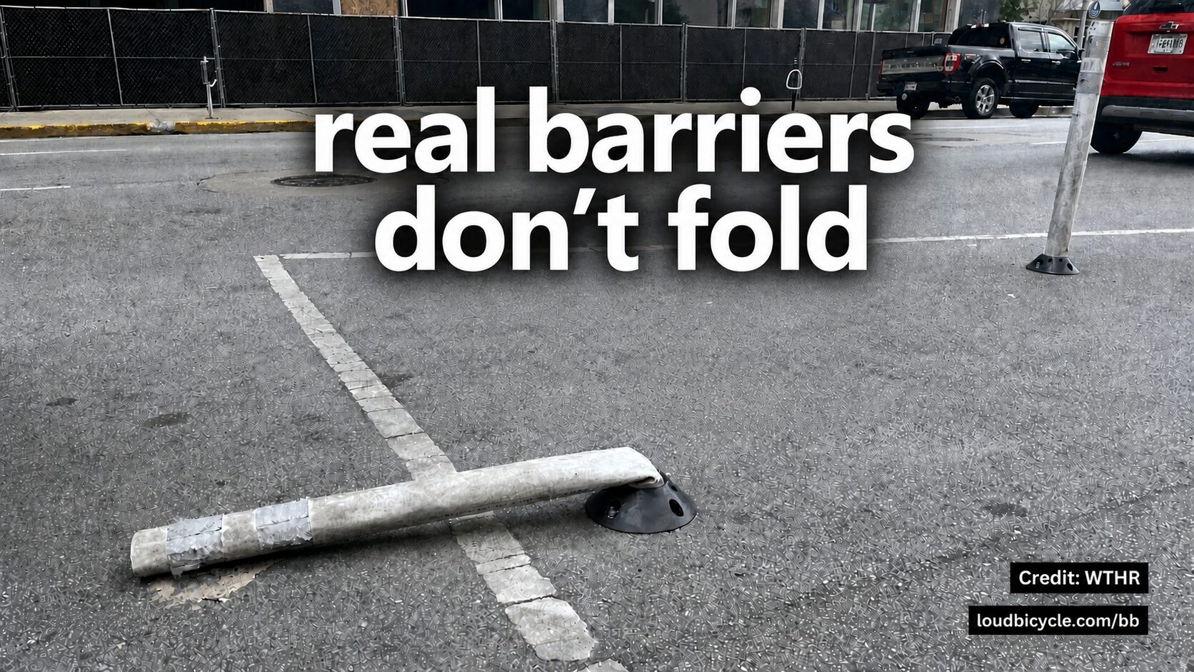
真正的障碍不会折叠
- Jonathan Lansey
- August 23, 2026
- 3 mins
- 基础设施
- bike bureau 停车 城市 自行车基础设施 自行车安全 道路安全
We looked at the bike lanes where people reported parked cars on Bike Bureau and noticed striking differences between separated bike lanes (green) and those “protected” (purple) with bollards and/or buffers.
我们查看了人们在 Bike Bureau 上举报有汽车停放其上的自行车道,注意到在实体隔离的自行车道(绿色)与那些通过弹性路桩和/或缓冲区”保护”(紫色)起来的车道之间存在明显差异。
Separated
A car physically can’t be there.
“Protected”
A buffer space or boingy bollards between the road and the bike lane.
Painted
Nothing at all between traffic and the bikes.
Reported
A person found a vehicle parked in the lane and reported it.
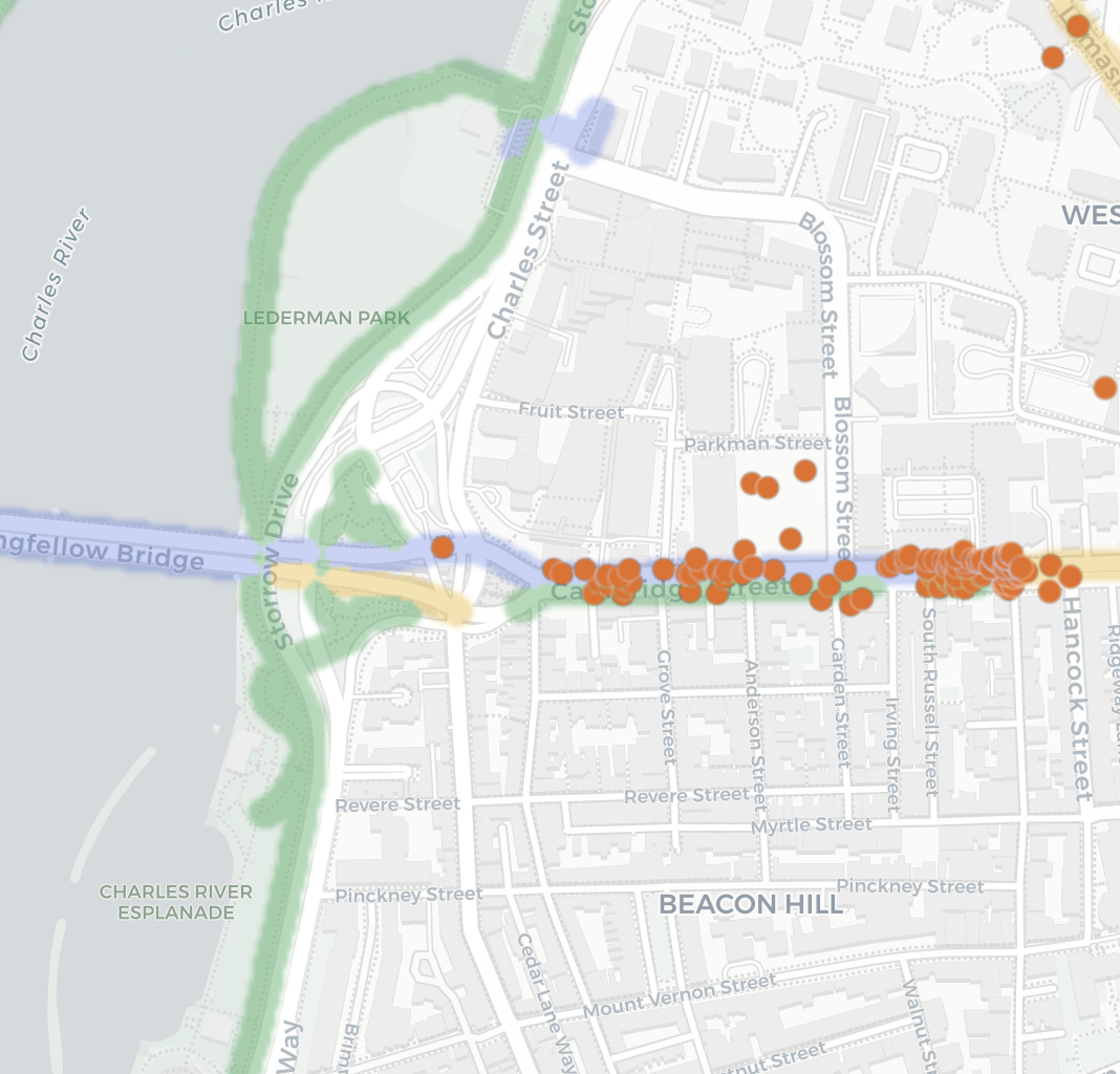
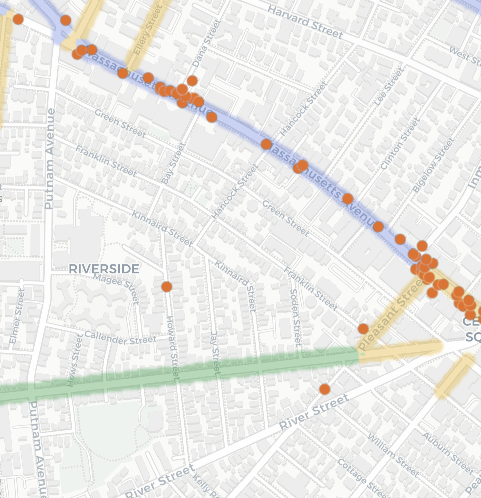
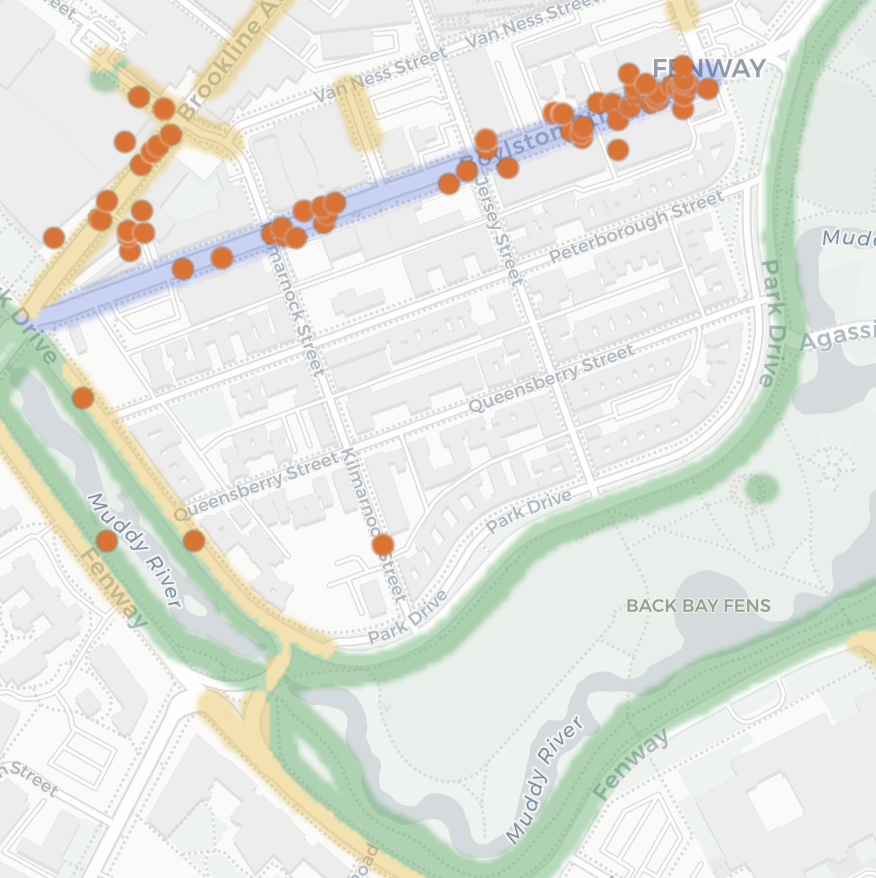
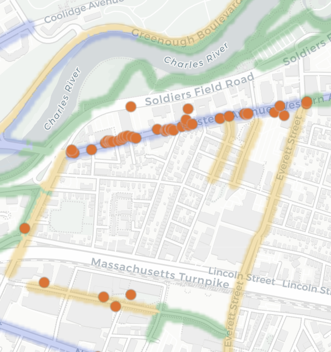
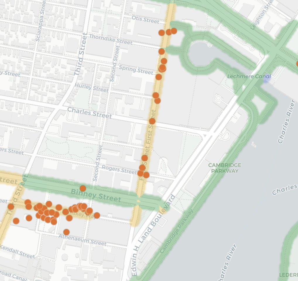
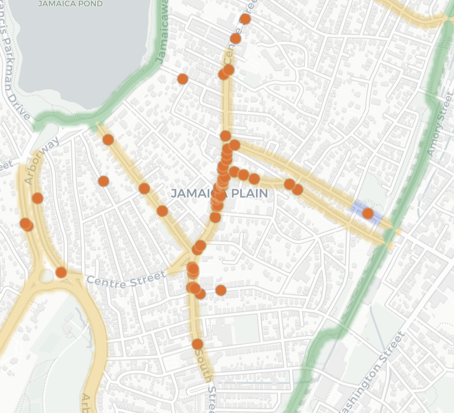
Tap any panel to open that neighborhood on the live map.
A parked car is evidence of a greater danger
停在车道上的汽车是更大危险的证据
Every orange dot marks a spot where a vehicle was parked blocking a bike lane. The green areas are separated bike lanes and the purple areas are “protected” bike lanes. If a car was physically able to enter the lane and park then the car can also barrel into someone biking in that lane. A separated lane solves both at once: no one can park in the lane and no one can be run over in the lane, the car simply cannot be there. That’s the only kind of protection that doesn’t depend on the person driving. Real barriers don’t fold.
每一个橙色圆点都标记了一处有车辆停放并堵塞自行车道的位置。绿色区域是实体隔离的自行车道,而紫色区域是所谓”受保护”的自行车道。如果一辆汽车在物理上能够驶入这条车道并停放,那么这辆车同样可以冲进正在车道中骑行的骑行者。实体隔离的车道一次性解决了这两种问题:没有人可以在车道里停车,也没有人会在车道里被车碾过,因为汽车根本不可能出现在那里。这是唯一一种不依赖驾驶者行为的保护形式。真正的物理隔离不会被撞倒。
References
参考文献
- Loud Bicycle. “Bike Bureau: Report Bike Lane Obstructions.”
- Loud Bicycle. “Bike Bureau Public Map.”
- OpenStreetMap contributors. OpenStreetMap. Basemap and bike-lane data.